
Bond Hill
Annexed in 1903
Get To Know Bond Hill
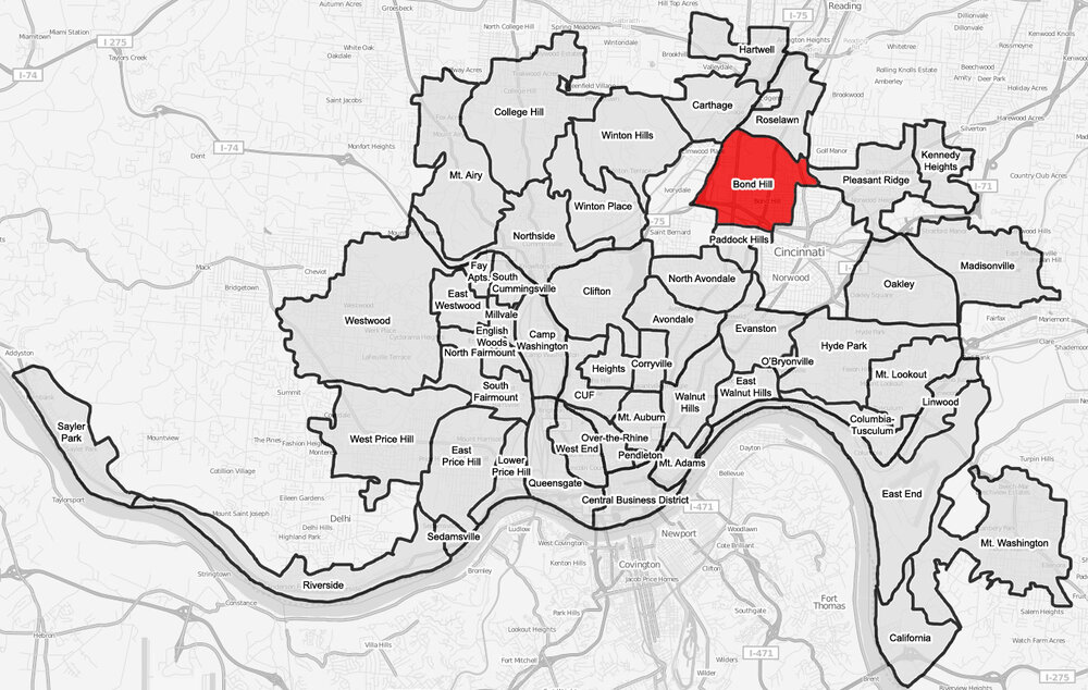
Bond Hill is a neighborhood about 6 miles north of downtown Cincinnati. It was incorporated as a village in 1886 before being annexed into the city in 1903. Named after a sawmill owner, this originally rural area now has over 6,900 residents and is Cincinnati’s 16th largest neighborhood. Paddock and Reading Roads run North/South through the neighborhood. Bond Hill is the only neighborhood that the Norwood Lateral intersects.
Cultural Intersection

The circle at this intersection represents the strength and unity of the neighborhood.
Bird’s-Eye View
Black represents the rich soil and the Mill Creek on the Western border. Green represents the pear orchards that once grew on the land.
Northern Star

The Cincinnati (seven point) star placed at the convergence of white stripes represents Bond Hill as the crossroads of the City.

Bond Hills’ colors are Green, Black & Blue
Green for the pear orchards that originally populated the neighborhood.
Black for the Mill Creek and the legacy of multi-generational families in the neighborhood.
Blue for the wayfinding signage in the neighborhood.
Bond Hill is…
an northern Cincinnati neighborhood on the move that is home to more than 6,900 residents, Graeter’s Ice Cream HQ, Givaudan Flavors, Community Action Agency, and Woodward High School.